
Advertisement
MH370 data to help build global map of the ocean floor
Jun 22, 2018
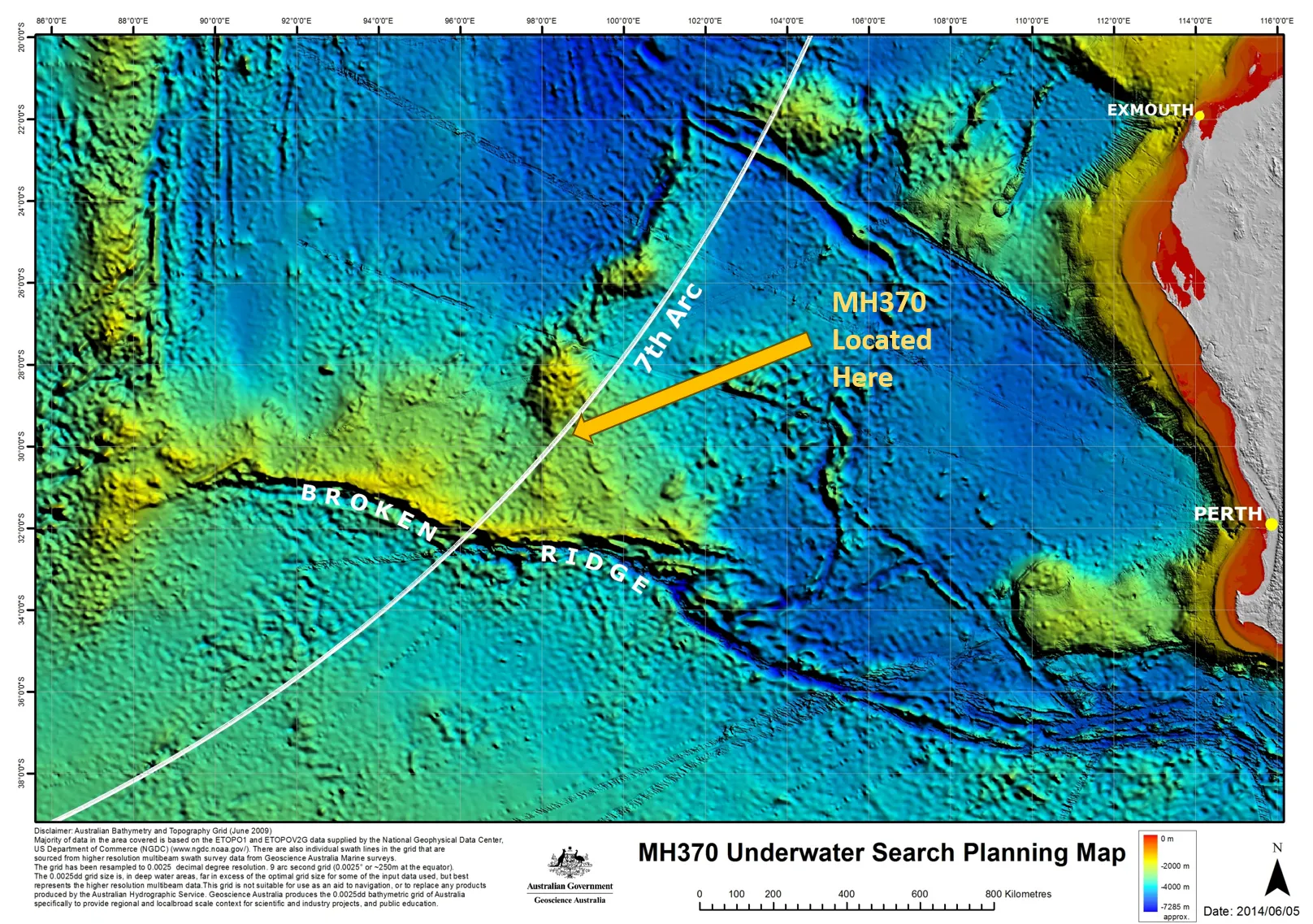
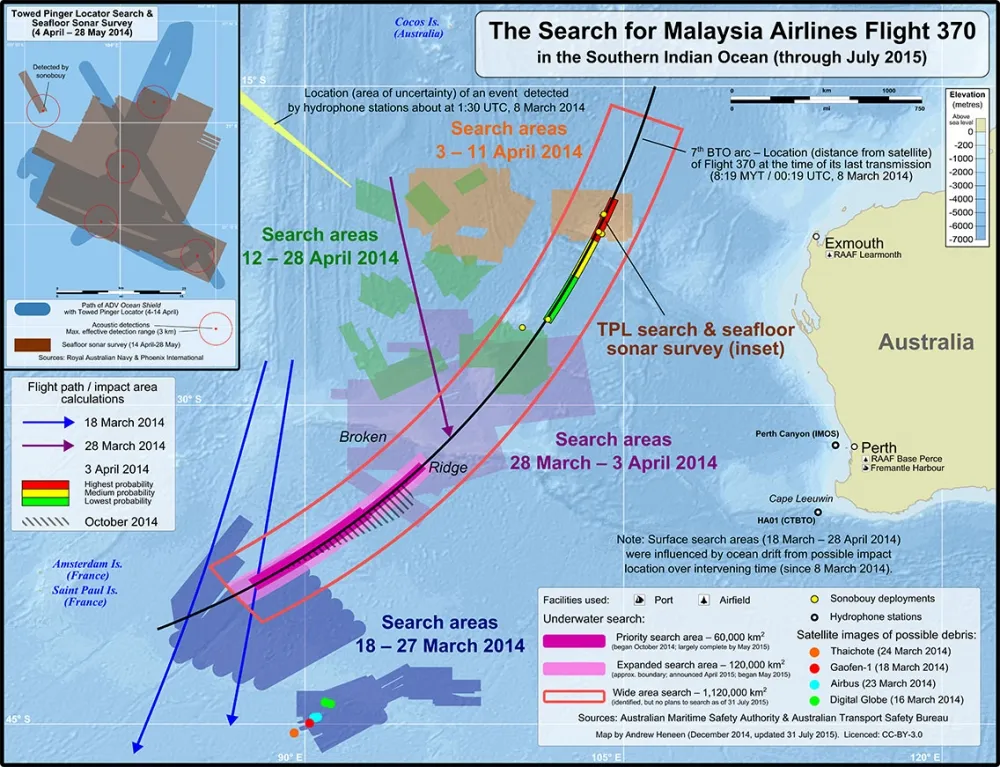
The disappearance of Malaysia Airlines Flight MH370 in 2014 has sparked extensive oceanographic research and exploration efforts, significantly contributing to the mapping of the ocean floor. Data collected from search operations, including sonar scans and underwater imaging, has revealed previously uncharted topographies, such as underwater mountains, valleys, and trenches. This information not only aids in understanding the flight's last known location but also enhances global oceanic knowledge. The collaboration between scientists and oceanographers has transformed the tragedy into a valuable opportunity for advancing marine research and improving navigation safety, while fostering a deeper understanding of the vast ocean environment.
The mystery of "MH370" has captivated the world since its disappearance in 2014, sparking countless theories and investigations. However, recent advancements in oceanographic research have found a silver lining in this tragedy. The data collected during the search for "MH370" is now being utilized to help build a comprehensive global map of the "ocean floor". This initiative not only aims to solve the mystery of the missing aircraft but also to enhance our understanding of the vast and largely unexplored underwater terrain.
The Importance of Ocean Mapping
Mapping the "ocean floor" is crucial for various reasons. It aids in navigation, supports marine research, and plays a significant role in environmental conservation. Detailed maps can help scientists identify underwater ecosystems and monitor changes due to climate change. Furthermore, they are essential for maritime safety and resource management. The data from "MH370" offers a unique opportunity to fill in gaps in our knowledge about the ocean's depths.
How MH370 Data is Utilized
The data collected during the search for "MH370" includes sonar imagery and other relevant oceanographic measurements. This information is being integrated into existing datasets to enhance the accuracy of "bathymetric maps". These maps portray the underwater landscape, revealing features such as ridges, valleys, and plateaus. By utilizing advanced technologies like "multibeam sonar" and "LiDAR", researchers can create high-resolution images of the ocean floor that were previously unattainable.
Collaboration Among Scientists
The endeavor to map the "ocean floor" using "MH370" data involves collaboration among scientists, marine geologists, and oceanographers worldwide. Institutions and organizations are pooling their resources to analyze the extensive data collected. This collaboration fosters innovation in mapping techniques and improves our understanding of the ocean's geology, hydrology, and biology.
Benefits to Marine Biodiversity
One of the significant advantages of creating detailed "ocean floor maps" is the potential to protect marine biodiversity. By understanding the topography of the sea bed, researchers can identify critical habitats for various marine species. This information can guide conservation efforts and help establish marine protected areas. The data derived from "MH370" not only assists in mapping but also serves as a foundation for future research on marine conservation strategies.
Technological Advances in Mapping
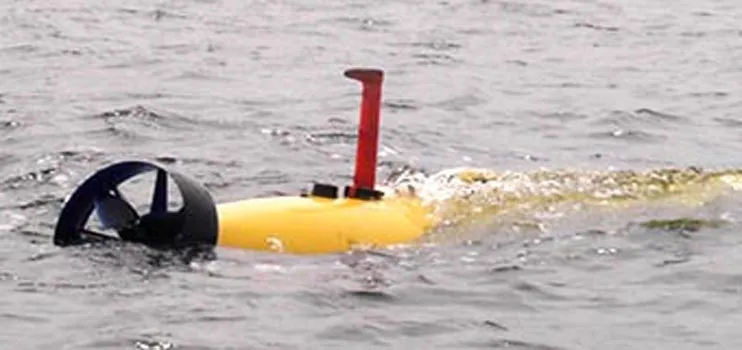
The integration of "MH370" data into ocean mapping efforts highlights the technological advancements in marine research. The use of autonomous underwater vehicles (AUVs) equipped with advanced sonar technology allows for more efficient data collection. These vehicles can operate in challenging underwater environments, covering vast areas of the ocean floor that were once difficult to explore. With continued technological improvements, the hope is to create near-complete maps of the world's oceans.
The Future of Ocean Exploration
As the global initiative to map the "ocean floor" progresses, there are plans to share this data with the public and the scientific community. Open data initiatives will allow researchers, policymakers, and environmentalists to access this vital information. The ultimate goal is to promote sustainable practices and enhance our understanding of ocean dynamics. The legacy of "MH370" could lead to a new era of ocean exploration and conservation.
Conclusion
The data gathered during the search for "MH370" is playing a pivotal role in the quest to map the "ocean floor" globally. By employing advanced technologies and fostering international collaboration, researchers are not only working to uncover the mystery of the missing aircraft but also enhancing our understanding of marine ecosystems. The implications of this research are far-reaching, from improved maritime safety to better conservation efforts. In this way, the legacy of "MH370" can contribute positively to our knowledge of the oceans and the preservation of their invaluable resources.
As we move forward, it is imperative to continue supporting such initiatives, recognizing the interconnectedness of our marine environments and the importance of sustainable practices. The story of "MH370" may be a tragic one, but its contribution to oceanic research is a hopeful reminder of how data can lead us to a better understanding of our planet.


Advertisement
Related Articles

Yet more theories about MH370 debunked.

World Expert; Not finding MH370 risks more lives
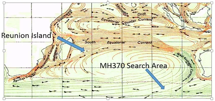
Will reverse drift modelling find MH370?
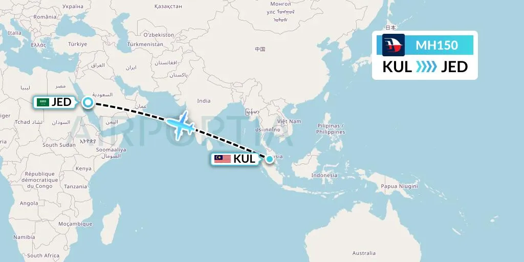
Was MH150 The Intended Target Not MH370?

Vanished plane not without precedent

US safety veteran backs call for MH370 search to be extended.

UPDATED: New MH370 study suggests it's further north

Updated: New MH370 search area not specific enough, says Minister.
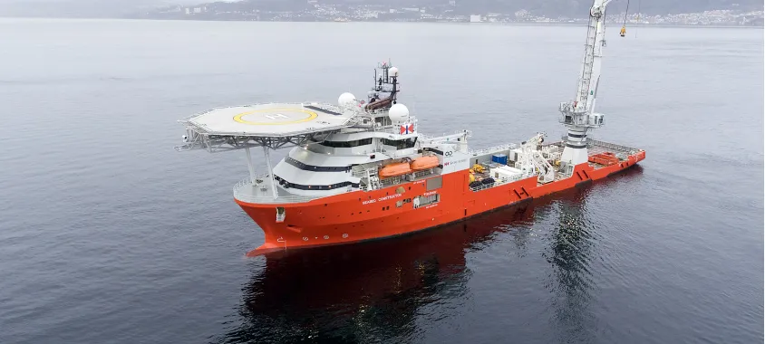
Updated: MH370 ship heads towards search area

Unprecedented MH370 findings boost pressure to resume search
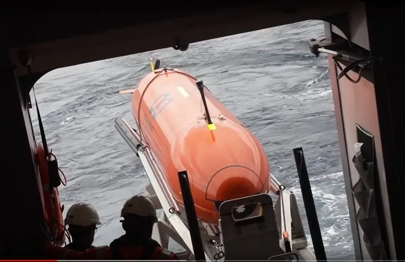
Underwater search vehicle to be deployed in MH370 search

Timeline for MH370
Thomas Discusses MH370 Report On Skynews
The beginning of the end of the MH370 search

Suitcase also found near piece of wing, is it from MH370?

Startling revelations demand a reopening of MH370 investigation